Notional Significance: Crossroads
[See all Notional Significance posts]
Another bend; another ending. I cross into Tawa, which was a separate borough until 1989, when in the words of a former Mayor it was “just tacked on” to Wellington. Topographically, and perhaps in sentiment, it still leans more towards Porirua than to Lambton Harbour. But as the old track changes names from Middleton Road (with the militaristic baggage of its eponymous stockade) to the bucolic cadence of Willowbank Road, on paper I remain in Wellington City.
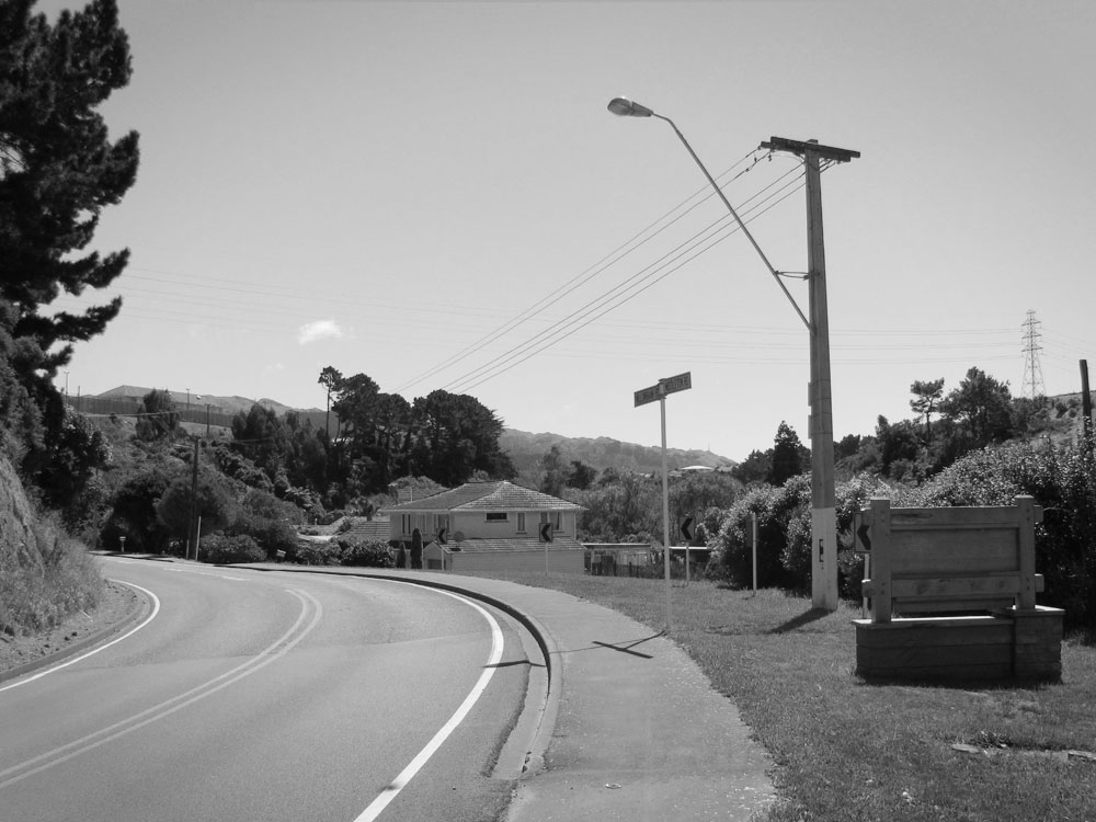
Not exactly suburbia. Millhouses and gorse; rickety bridges; high tension lines. Compounds for the containment of dogs and wayward women. And beside me all the time, that unwholesome botch of raw earth still rearing up across the river. Flaxen mitigation scrabbles across the hard-scraped clay, but the razored horizon evinces unspeakable crimes against the landscape. It’s a battered slope, in every sense; a shallow grave as seen by an ant; a barrow where the entombed is the earth itself.
At the crossroads, a topiaried welcome. The letters T A W A bloom forth in trimmed flora, but this geographical reminder is redundant beside the truncated coniferous cone known as the Bucket Tree, which ranks just below Dressmart in the pantheon of Tawa signifiers. These symbols of fussily-tended domesticity look almost appealing in the weary heat of late summer, but my task is to shadow the highway, so I head east across the river.
I negotiate roundabouts, looking for the track that will take me down to the stream and then on to my planned route. But the monstrous earthworks exert a perverse pull, and I drift across the road and up a stub of a track towards the top of the manufactured mesa. I pass between concrete cubes and enter a forgotten world that goes by the name of Takapu Island.
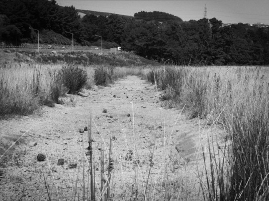
While that might conjure images of a lonely isle lapped by calm waters, its insularity is a symptom of the more hectic currents of modern life. It is a teardrop of land, wrenched from its context by motorways, interchanges and railways. Flattened and pummelled by years of earthworks (of varying degrees of legality), this desert(ed) island resembles one of those “lost world” tablelands that preserves fabled ecosystems. But there are no carnivorous plants or unicorn skulls to be found here, just the familiar edgelands species: pylons, gas pipes, Armco and gravel. Reeds and cracked clay delineate the sites of dried-up ponds; some have the uncanny linearity of ley lines. Thousands of pinecones lie strewn through the resurgent gorsefields, evidence of some forgotten arboreal atrocity. Infant gorse crunches menacingly underfoot, and I muse on the role of gorse as the landowner’s biological weapon against squatters and ramblers: there’s no right to roam in a country where any abandoned land rapidly transforms into an impenetrable mass of thorns.
The pen might be mightier than the sword, but the bulldozer is mightier than my keyboard. Since my excursion the abandonment has ended, and the end game for this defeated land is in sight. A supermarket has sprung from the gorse, its red-slashed roughcast looking less inviting than the curiously domestic form of Arohata prison across the valley. The rest of the island awaits its fate: an asphalt tomb with tilt-slab headstones.
I make a desultory circumnavigation of the island, pausing to savour the roaring proximity of the motorway that defines its eastern shore. Beyond, a tarmac knot of ramps and underpasses, the lazy curves of the interchange defined by the physics of deceleration. Beyond that, Grenada North, with its boxy concrete ramparts; then the long ridgeline of Horokiwi shimmering in the burnt blue heat. A billboard reads “Now in CBD”, and I rather wish I was.
I traipse back down the access road, then east again towards the interchange. Opposite a caged tangle of pipes, I follow a rough track down to the valley. In the relative cool, another intersection: the confluence of the Takapu and Kenepuru streams. This also marks the point where the Korokoro-Porirua track met the Old Porirua Road; a crossroads for hundreds of years. Now it is quiet and still, the din of today’s crossroads lost in the leafiness overhead.
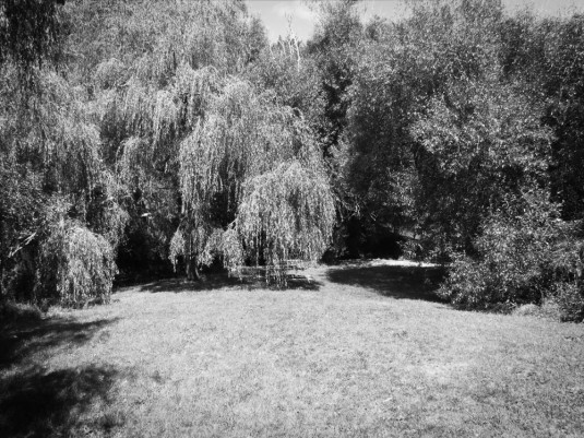
The place exudes an ancient, long-settled feeling, a very un-Wellington sense of deep and calm belonging, rather than the hard-won tenacity of clinging to a hillside in a gale. A benevolent genius loci overlooks this Arcadian vale: homely, and yet for that very reason unhomely to the gust-accustomed. Willowbank Reserve, with its soft lawns and weeping eponyms, is a remnant of the Boscobel orchard, and nearly 150 years later its boskiness remains in the form of rare apple cultivars.
But even that was preceded by Māori cultivation grounds. The confluence of streams became a confluence of paths and then a place to grow crops; today, the confluence of motorised paths still brings people to this crossroads to seek food—though now their pataka is a concrete box and their kete have four wheels. Like the multiple trunks of the Bucket Tree that some say have now fused into a “natural graft”, physical, cultural and economic imperatives coalesce into a living, deeply rooted entity that we call “place”. It’s just that now, we trim it into unnatural shapes.
A track leads through the woods and up the hill. It opens onto a driveway, which opens onto the bulbous cul of a distended sac: Taylor Terrace. I am now in Tawa proper. The suburbs.
I’ve missed this. Welcome back, Alf.
I’ve updated the Google Map with the latest two legs.
https://maps.google.com/maps/ms?msid=207347148529868019027.0004a024ca0abcb4c44d7&msa=0&ll=-41.262066,174.79969&spn=0.168008,0.303497
Also – my sympathies are with you as you recount your suburban experience.
Many thanks! The map gets fiddly in these places where I don’t always follow the official roads.
My old boss lived in Taylor Tce and would take his kids down to the park and hide 20c pieces in the bark of the trees, pretending to them that they had grown magically