Get Informed About Resource Consents
It’s a common complaint: “how could the Council let people build that, and not even notify anyone?” That’s partly down to a misunderstanding of what “notification” means under the RMA: it’s not just about letting people know, but also the start of a long and complex process involving hearings, lawyers and possible appeals, and it only occurs when a proposal goes some way beyond what’s permitted under the District Plan. Most resource consents aren’t notified in that sense, but they are public information, so theoretically everyone should be able to know about it.
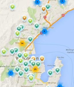 In practice, though, it’s not that easy. Lists of recently received or issued consents are published on the WCC website every fortnight, but you have to remember to look, download a PDF, and scan through to see if anything might affect you.
To make that easier, I’ve been doing some work with local company Thundermaps to gather this information, map it, and let you receive alerts when something pops up. I’ve written a full description on their blog, but all you have to do is:
- sign up (it’s free);
- draw the area that you’re interested in; and
- receive email alerts or smartphone notifications whenever the Council publishes information about a new consent in that area.
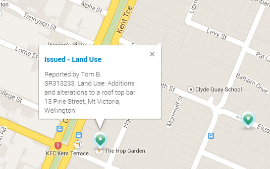
If you don’t want the notification service, you can just go and browse the map to see what’s happening across Wellington. At the moment, we’re just gathering public information about WCC consents, and this is only updated every fortnight, but we hope to get other Councils on board to make it easier for everyone to keep in the loop about developments in their community. That would make it easier for everyone to see, for instance, that…hey, a rooftop bar in Mt Vic!
Fantastic initiative, Tom. And love your bio.