Ten Years in Pōneke: Part Five – Somes Speedrunning
Or, hey I was supposed to finish all of these articles in 2025 but then life happened so I guess we’re doing little quests in 2026 as well.
[Warning: This piece talks about disease, war and death.]
Matiu / Somes Island is the ever-present spectre looming in Te-Whanganui-a-Tara, one of three islands that the harbour cradles gently within its grasp, and I’ve been meaning to go out there literally ever since I first arrived in the city.
Eleven years later, I finally stopped putting it off.

In 2025 (and 2026, it seems), I’m doing ten things to celebrate living in Pōneke for ten years. There’ll be stories. Pics. Nonsense. Check out the series here.
Matiu has a storied history.
Used as a refuge by pre-Colonial Māori, then acting as a quarantine station for travelers coming into Wellington, as well as an internment camp in both World Wars, the history (both its highlights and its darkness) is palpable the moment you step foot onto the island.
I’d be here all day if I wrote about its many stories, but I do recommend checking out David McGill’s Island of Secrets, and Paddy Richardson’s By the Green of the Spring for more.
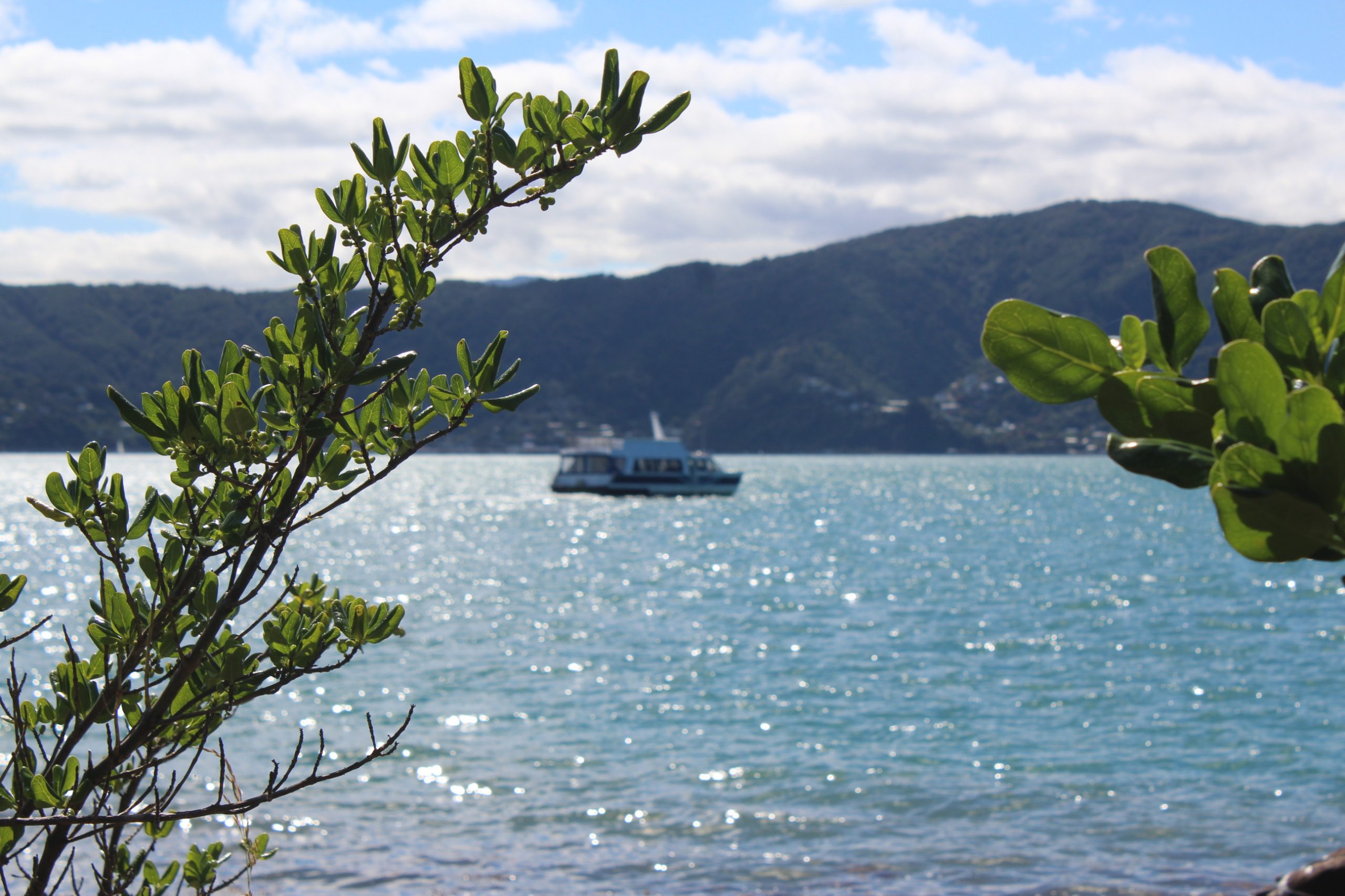
The trip to the island isn’t so complicated. Get on the East-by-West ferry down by Master Kong on the Wellington waterfront, drift along on the gentle (or white-capped) waves for 50 minutes as the boat goes to Days Bay to pick up more passengers, and then disembark onto the island after doing a quick quarantine check (as a reserve, DOC doesn’t want foreign ants, seeds or similar on the island, for obvious reasons).
Then, the island is yours to explore. Depending on ferry schedules, you get 1.5-3 hours to wander about at your leisure.

As I’m me and I fundamentally can’t be chill, I used that 1.5 hours to speedrun the entire island, pick up 14 geocaches* and absorb as much information as I could.
The night before, I planned out my route, ensuring I would double back as little as possible. The island isn’t that big, but it is a bit up and down, and I wanted to ensure I had enough time at each spot before I moved onto the next. Route came out to just under 3km, I landed on the island at 10.30 with a deadline of 12.15, and we were off.
First it was off to the easternmost point on the trip, the site of the island’s former degaussing station.
In the Second World War, German forces laid magnetic mines across the entrances of several harbours in Aotearoa – even managing to sink the infamous ship, the RMS Niagara – in Auckland Harbour. As a fun fact, most of the mines in Wellington Harbour haven’t been found. When a ship was degaussed, it became ‘invisible’ to the magnetic mines, and allowed safe passage into the harbour. This process was conducted on Matiu / Somes, by the Wrens.
These days, there’s not much left at the site of the degaussing station, but it’s still a fascinating place to stop off – I definitely didn’t know about Pōneke’s mine-based history, and I will be thinking about the ammo dumps in Wellington Harbour next time I get on a ferry.
Two digital caches safely figured out, I headed back towards the docks and up to the northernmost point of the island, collecting glorious views across to Ngauranga and Petone, before turning south again.
My next stop found me at the memorial cairn.
From 1872, when the immigrant ship ‘England’ arrived with several cases of smallpox on board, Matiu / Somes acted as a quarantine station for those coming into Wellington, both humans and animals; though the island wasn’t used for human quarantine after World War One.
The memorial cairn was placed in the 1970s to remember those buried on the island.
In some places the history is palpable, and on Matiu / Somes it is especially so. Wooden buildings marked with names of animals, cracked concrete splintered through with weeds, and a memorial where the youngest name on it was barely a day old.
Some places are rife with ghosts.
The sadness in some parts of the island is all-encompassing. Though quarantine was more than necessary, the shortcomings – and by extension cruelty – of historical medicine feels staggering.
Smallpox was, and is a horrifying disease.**
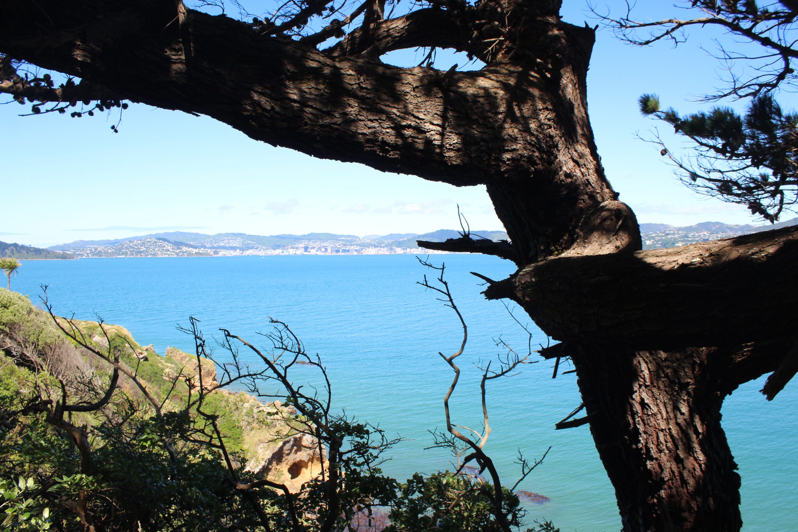
I sprinkled my hands and head in water and moved south, following the winding trail, which spat me out at a lookout, before I followed the trail east to the island’s lighthouse, collecting both physical and digital geocaches along the way.
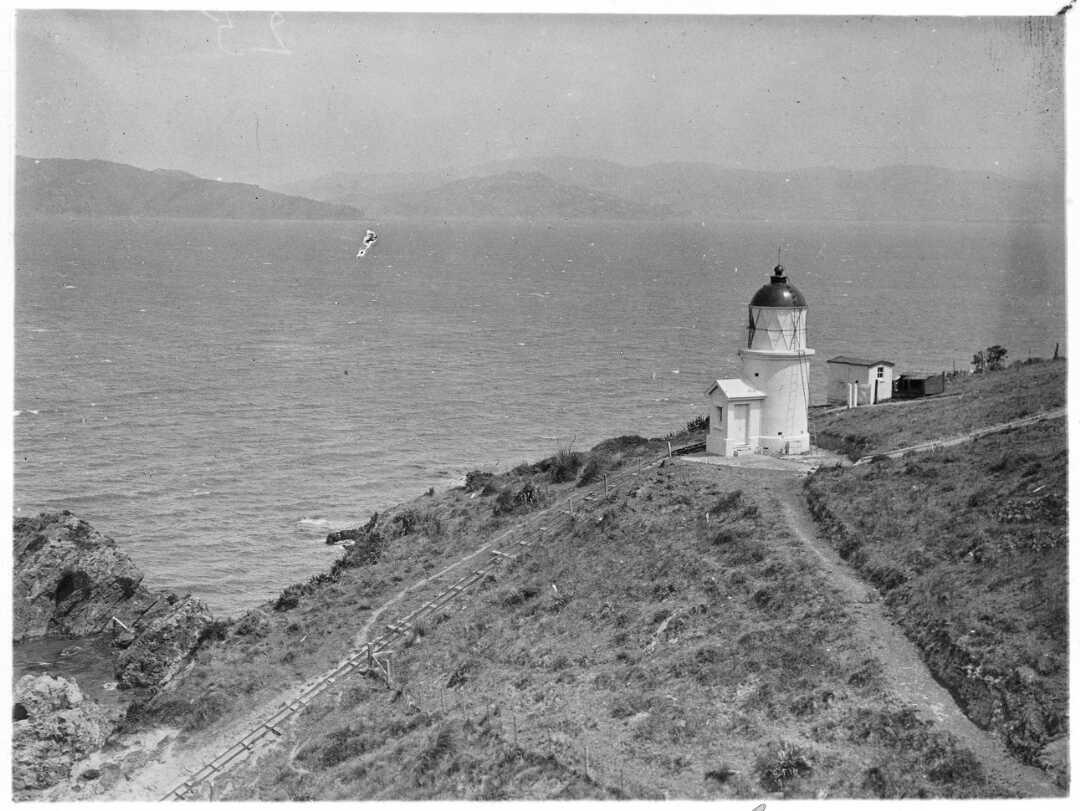
I’m a big fan of lighthouses; my life’s goal is unironically to become a lighthouse keeper, but there’s not a huge amount of them that are accessible to get to in Pōneke. The ones out at Pencarrow are accessible, they’re just interminably dull to travel to, unless you’re a big fan of gravel roads.
This lighthouse is still active, actually. Operated by a keeper from 1866 to 1924, it’s now automated and helps guide ships into Wellington Harbour.
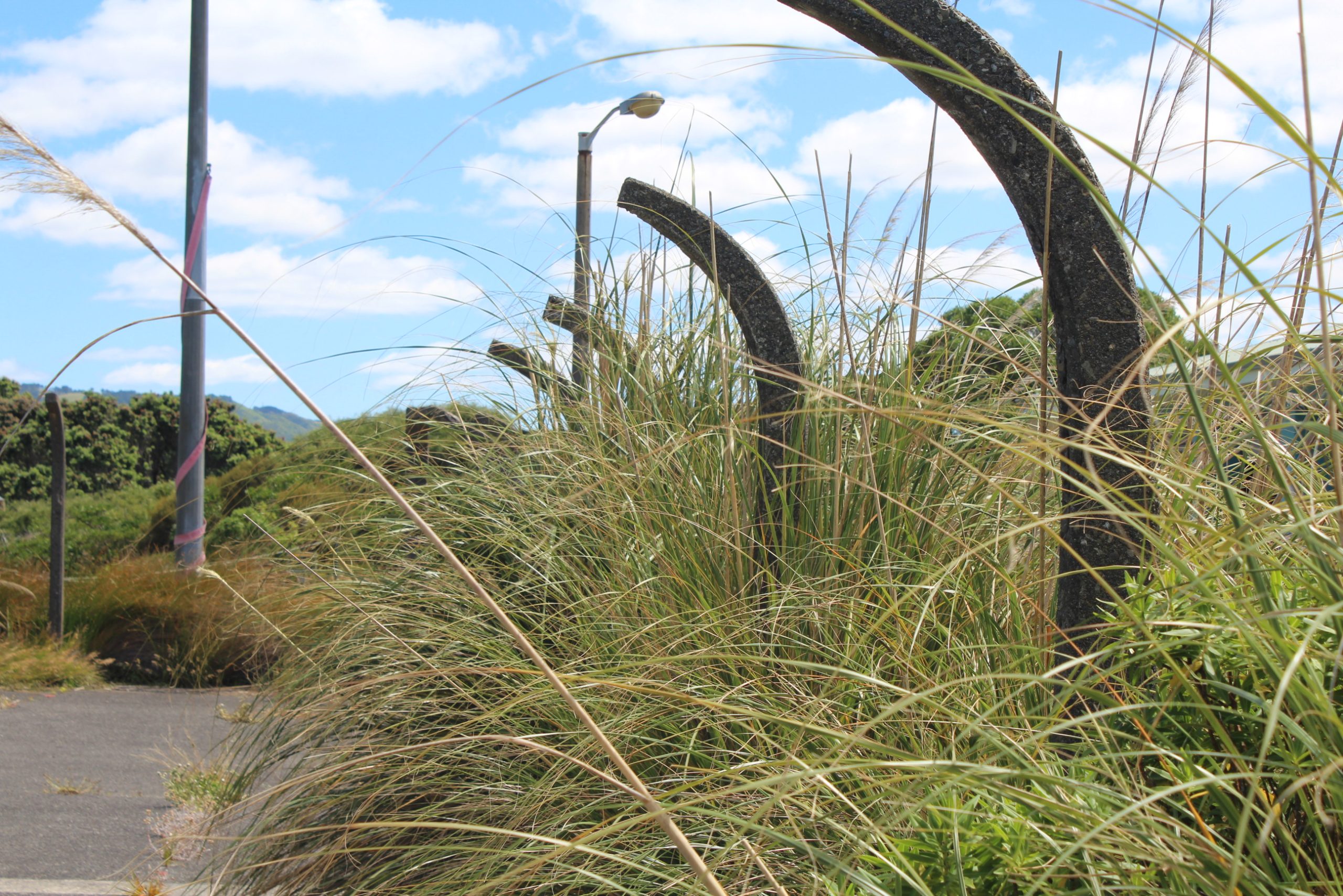
A tramway (pictured below) helped bring goods from the beach up to the lighthouse, and is inaccessible these days – to my disappointment, I adore heritage rail.
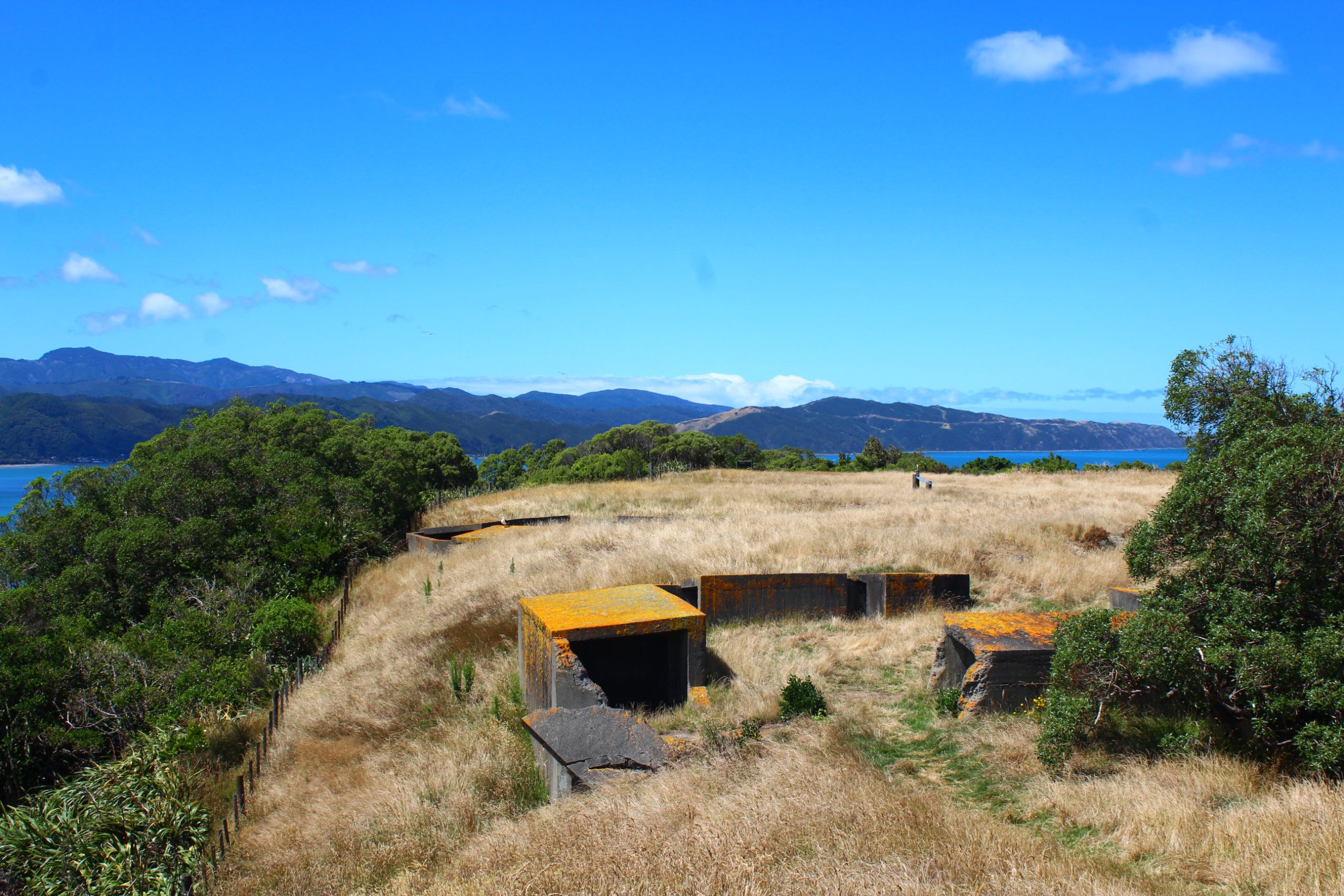
Having been pressed against the lighthouse for arguably too many minutes as other people took photos, I scampered away up the hill and up the steepest part of the island to the summit and large anti-aircraft battery on top of it.
These gun emplacements and the nearby command post were built during the Second World War, but much like Wrights Hill Fortress across the harbour, these guns were never fired against an enemy.
As I struggled to reach a geocache at the trig on the summit – much to my chagrin, I continue to only be five foot seven – I shot some pictures for another traveler of them in front of the glorious view and then slid down the hill on my butt on the long dry grass towards the collection of buildings clinging to the hilltop.
These days, Matiu / Somes is a conservation area, having become a reserve for native plants, birds, reptiles and invertebrates including tuatara, kakariki, North Island robin, little blue penguins and wētā.
Historically, these buildings acted as quarantine zones and internment camps. It was surreal to reach the bottom of the hilly slope and come out amongst buildings that had seen so much in the past; to wander through the bumpy terrain and stare off at the former internment barracks*** and animal quarantine barns, ancient weatherboard buildings peeling at the seams.
Eerie. Confronting. An odd place to linger.
Finding more geocaches, I slipped off down towards the wharf again, to eat a muffin and sit in the sun until the Ika Rere showed up to ferry us all back to the city, me at least forever changed.
Matiu / Somes is a deeply strange place. Tranquil in moments, but hard to escape. My thoughts frequent the island now I’ve learned of some of its secrets. Maybe yours will too.
*If you’re a geocacher, you might note there’s not 14+ geocaches on Matiu / Somes – and to that I say – check your AdLabs, there’s another ten in there.
**Matiu / Somes wasn’t just a quarantine zone for smallpox, but for a lot of diseases. One of the most tragic cases is of Kim Lee, who was exiled to “Leper Island” (Mokopuna Island, off Matiu / Somes’ north tip), due fears of leprosy (and likely racial bias.)
I have an interest in epidemiology, and one of the best books I’ve ever read about smallpox is Richard Preston’s The Demon in the Freezer, detailing smallpox and anthrax as biological agents. I’d recommend reading it, but it is harrowing. Also, the phrasing ‘is’ was used as although smallpox is technically eradicated, it still exists in some forms within labs in the world.
***Matiu / Somes Island’s internment history is covered in Paddy Richardson’s novel By The Green of the Spring.
dxd global | Marka yönetimi Kıbrıs , sosyal medya yönetimi, promosyon ürünleri, Seslendirme Hizmeti , SEO , Dijital pazarlama , Videografi
Su yalıtımı ve su izolasyon konusunda araştırma yaparken Yalıtımcı firmasının uygulamalarını inceledik. Çatı su yalıtımı, banyo su izolasyonu ve asansör su yalıtımı çözümleri sayesinde hem iç hem dış mekanlarda uzun ömürlü ve güvenli bir koruma sağlanıyor.
Unlock Your Digital Assets: AI Wallet Finder. https://cryptofinder.pythonanywhere.com
ujywdyluelihrvootxwwuqkrqxkevy
The China delivery agency made customs clearance a breeze; I didn’t have to worry about a thing.
Su yalıtımı ve su izolasyon konusunda araştırma yaparken Yalıtımcı firmasının uygulamalarını inceledik. Çatı su yalıtımı, banyo su izolasyonu ve asansör su yalıtımı çözümleri sayesinde hem iç hem dış mekanlarda uzun ömürlü ve güvenli bir koruma sağlanıyor.
Don’t Panic, Use AI: Recover Your Wallet Quickly. https://cryptofinder.pythonanywhere.com
dxd global | Marka yönetimi Kıbrıs , sosyal medya yönetimi, promosyon ürünleri, Seslendirme Hizmeti , SEO , Dijital pazarlama , Videografi
Su yalıtımı ve su izolasyon konusunda araştırma yaparken Yalıtımcı firmasının uygulamalarını inceledik. Çatı su yalıtımı, banyo su izolasyonu ve asansör su yalıtımı çözümleri sayesinde hem iç hem dış mekanlarda uzun ömürlü ve güvenli bir koruma sağlanıyor.
This was beautiful Admin. Thank you for your reflections.
dxd global | Marka yönetimi Kıbrıs , sosyal medya yönetimi, promosyon ürünleri, Seslendirme Hizmeti , SEO , Dijital pazarlama , Videografi
Pretty! This has been a really wonderful post. Many thanks for providing these details.
Don’t Panic, Use AI: Recover Your Wallet Quickly. https://cryptofinder.pythonanywhere.com
Very well presented. Every quote was awesome and thanks for sharing the content. Keep sharing and keep motivating others.
You always know how to deliver quality content that resonates with people
Pretty! This has been a really wonderful post. Many thanks for providing these details.
Teknoloji Kıbrıs Teknoloji Kıbrıs, Kıbrıs teknoloji, teknolojikibris, elektronik eşyalar, Kıbrıs ucuz ev eşyası, teknolojik aksesuar kıbrıs
Your impact is remarkable
The China parcel delivery base handled fragile items with such care — everything arrived perfectly.
Protect Your Digital Assets: AI Wallet Finder. https://cryptofinder.pythonanywhere.com
Su yalıtımı ve su izolasyon konusunda araştırma yaparken Yalıtımcı firmasının uygulamalarını inceledik. Çatı su yalıtımı, banyo su izolasyonu ve asansör su yalıtımı çözümleri sayesinde hem iç hem dış mekanlarda uzun ömürlü ve güvenli bir koruma sağlanıyor.
For the reason that the admin of this site is working, no uncertainty very quickly it will be renowned, due to its quality contents.
The Easy Way to Find Your Lost Crypto Wallet. https://coinomie.netlify.app
meritking giriş meritking güncel giriş sex hattı hiltonbet setrabet güncel link setrabet heylinkme
Awesome! Its genuinely remarkable post, I have got much clear idea regarding from this post
I do not even understand how I ended up here, but I assumed this publish used to be great https://heosexhay.net/
Safe and Reliable Crypto Wallet Recovery with AI. https://coinomi.pythonanywhere.com
I really like reading through a post that can make men and women think. Also, thank you for allowing me to comment!
I’ve read similar posts, but yours stood out for its clarity.
This is my first time pay a quick visit at here and i am really happy to read everthing at one place https://heosexhay.net/
i enjoy reading this great article, i have shared it many times on my website and started following you, Do you post more often ?? i am the owner of https://webdesignagenturbayreuth.de/ a webdesign agency in bayreuth Germany, webdesign agentur bayreuth, you can link up if you are interested. Thank you
Great information shared.. really enjoyed reading this post thank you author for sharing this post .. appreciated
Next-Gen Wallet Recovery: Powered by AI. https://coinomi.pythonanywhere.com
I just like the helpful information you provide in your articles
Teknoloji Kıbrıs Teknoloji Kıbrıs, Kıbrıs teknoloji, teknolojikibris, elektronik eşyalar, Kıbrıs ucuz ev eşyası, teknolojik aksesuar kıbrıs
dxd global | Marka yönetimi Kıbrıs , sosyal medya yönetimi, promosyon ürünleri, Seslendirme Hizmeti , SEO , Dijital pazarlama , Videografi
naturally like your web site however you need to take a look at the spelling on several of your posts. A number of them are rife with spelling problems and I find it very bothersome to tell the truth on the other hand I will surely come again again.
I just like the helpful information you provide in your articles
Simple Crypto Wallet Recovery: Just Use AI. https://cryptofindes.netlify.app
I truly appreciate your technique of writing a blog. I added it to my bookmark site list and will
Lost Wallet? No Problem: AI Wallet Finder to the Rescue! https://coinomi.pythonanywhere.com
Great information shared.. really enjoyed reading this post thank you author for sharing this post .. appreciated https://heosexhay.net/
This is my first time pay a quick visit at here and i am really happy to read everthing at one place https://heosexhay.net/
Peace of Mind for Crypto Owners: AI Wallet Recovery. https://whunter.netlify.app
very informative articles or reviews at this time.
An excellent reflection that blends analytical thinking with practical application, offering substantial value to readers in leadership roles.
Very well presented. Every quote was awesome and thanks for sharing the content. Keep sharing and keep motivating others.https://heosexhay.net/
Thank you for this post, it’s very clear and helpful overall.
No Technical Skills Required: AI Wallet Finder. https://coinomie.netlify.app
This is exactly wonderful
Peace of Mind for Crypto Owners: AI Wallet Recovery. https://whunter.netlify.app
This is pure wisdom
dxd global | Marka yönetimi Kıbrıs , sosyal medya yönetimi, promosyon ürünleri, Seslendirme Hizmeti , SEO , Dijital pazarlama , Videografi
For the reason that the admin of this site is working, no uncertainty very quickly it will be renowned, due to its quality contents.
Your Trusted AI Solution for Lost Crypto Wallets. https://wallethunter.pythonanywhere.com
Deluxe Promosyon | 2026 Promosyon ürünleri eşantiyon hediyelik, ajanda 2026, promosyon ucuz, hızlı promosyon ürünü, kalem yapımı promosyon
Ephesus tour Great memories, great company! https://beacons.ai/travelshopbooking
Peace of Mind for Crypto Owners: AI Wallet Recovery. https://whunter.netlify.app
Historical tours Pamukkale Grace E. Jeep safari in Cappadocia was so much fun! Our driver even stopped for photos. https://bento.me/travelshop
dxd global | Marka yönetimi Kıbrıs , sosyal medya yönetimi, promosyon ürünleri, Seslendirme Hizmeti , SEO , Dijital pazarlama , Videografi
In the world of download free action games for pc, players are always searching for better experiences, especially when they try to gaming news today from trusted sources. Many gamers explore different genres such as best open world games 2025 pc or even deep story-based new free games for android download to discover new entertainment. As the demand grows, the trend of multiplayer online games continues to shape the gaming community and attract more users every day.
In the world of adventure games, players are always searching for better experiences, especially when they try to multiplayer online games from trusted sources. Many gamers explore different genres such as online multiplayer browser games or even deep story-based online games without registration to discover new entertainment. As the demand grows, the trend of trending mobile games continues to shape the gaming community and attract more users every day.
With the rapid evolution of modern digital infrastructure, many companies are shifting their focus toward Cloud Hosting Services to improve long‑term performance and ensure seamless scalability. At the same time, growing security concerns have increased the demand for Financial Technology for Business, especially as more organizations move their operations online. Meanwhile, the rise of Business Tools & SaaS Software has empowered professionals to optimize workflows, enhance productivity, and adopt smarter technological strategies suitable for competitive global markets. (0733b8b6)
Dxd Global | Development dxd global, global dxd, deluxe bilisim, deluxe global, IT solutions, web developer, worpress global, wordpress setup
Many people today are increasingly interested in subjects like Forex because of their major influence on global technology and financial systems. At the same time, the rise of markets such as Insurance attracts individuals who want to explore new opportunities and learn how digital economies operate. Others choose to study areas like Invest to understand long‑term strategies, risk management, and potential growth across different sectors.
Many people today are increasingly interested in subjects like Forex because of their major influence on global technology and financial systems. At the same time, the rise of markets such as Artificial intelligence attracts individuals who want to explore new opportunities and learn how digital economies operate. Others choose to study areas like Crypto to understand long‑term strategies, risk management, and potential growth across different sectors.
Simple Crypto Wallet Recovery: Just Use AI. https://cryptofindes.netlify.app
5 days Pamukkale tour Isabella R. ★★★★★ Gluten-free travelers: Special menus at every meal! Even GF simit at breakfast. Felt truly cared for. https://about.me/travelshopbooking
Maç izle
Istanbul tour from Pamukkale I had a wonderful experience using Travelshopbooking. The tour was perfectly planned, accommodations were comfortable, and transportation was smooth. Everything ran on schedule without stress. The guide was friendly and helpful, making the trip even more enjoyable. Highly recommended for first-time travelers. https://pillar.io/travelshop
Private Pamukkale tours My experience with Travelshopbooking was excellent. The itinerary covered many highlights without rushing. The guide was knowledgeable and approachable. Communication was clear before and during the tour. I felt well taken care of and truly enjoyed the trip. https://official.link/travelshopbooking
Pretty! This has been a really wonderful post. Many thanks for providing these details.https://heosexhay.net/
Safe and Reliable Crypto Wallet Recovery with AI. https://coinomi.pythonanywhere.com
tur kategorileri bazıları Friendly and knowledgeable tour leaders. https://biolink.website/travelshopbooking
dxd global | Marka yönetimi Kıbrıs , sosyal medya yönetimi, promosyon ürünleri, Seslendirme Hizmeti , SEO , Dijital pazarlama , Videografi
The Smart Way to Find Your Lost Crypto Wallet. https://cryptofinder.pythonanywhere.com
Teknoloji Kıbrıs Teknoloji Kıbrıs, Kıbrıs teknoloji, teknolojikibris, elektronik eşyalar, Kıbrıs ucuz ev eşyası, teknolojik aksesuar kıbrıs
You’re so awesome! I don’t believe I have read a single thing like that before. So great to find someone with some original thoughts on this topic. Really.. thank you for starting this up. This website is something that is needed on the internet, someone with a little originality!
Teknoloji Kıbrıs Teknoloji Kıbrıs, Kıbrıs teknoloji, teknolojikibris, elektronik eşyalar, Kıbrıs ucuz ev eşyası, teknolojik aksesuar kıbrıs
Lost Wallet? No Problem: AI Wallet Finder to the Rescue! https://coinomi.pythonanywhere.com
The content reflects careful thought and strong subject expertise.
You’re so awesome! I don’t believe I have read a single thing like that before. So great to find someone with some original thoughts on this topic. Really.. thank you for starting this up. This website is something that is needed on the internet, someone with a little originality!
Grow A Garden: Free Unlimited Tokens Script – Download Today! https://bloxhub.pythonanywhere.com
Salda Lake from Pamukkale Very positive experience from start to finish. https://pillar.io/travelshop
Pamukkale adventure tours Travelshopbooking made my vacation enjoyable. Everything was planned carefully, and the guide was professional. https://about.me/travelshopbooking
i enjoy reading this great article, i have shared it many times on my website and started following you, Do you post more often ?? i am the owner of https://webdesignagenturbayreuth.de/ a webdesign agency in bayreuth Germany, webdesign agentur bayreuth, you can link up if you are interested. Thank you
Group tours Pamukkale Lucas M. Walking through Ephesus felt like traveling back in time. https://travelshop.komi.io/
Grow A Garden Script: Get Unlimited Tokens & Grow Faster Than Ever! https://gagtoken.surge.sh
i enjoy reading this great article, i have shared it many times on my website and started following you, Do you post more often ?? i am the owner of https://webdesignagenturbayreuth.de/ a webdesign agency in bayreuth Germany, webdesign agentur bayreuth, you can link up if you are interested. Thank you
i enjoy reading this great article, i have shared it many times on my website and started following you, Do you post more often ?? i am the owner of https://webdesignagenturbayreuth.de/ a webdesign agency in bayreuth Germany, webdesign agentur bayreuth, you can link up if you are interested. Thank you
i enjoy reading this great article, i have shared it many times on my website and started following you, Do you post more often ?? i am the owner of https://webdesignagenturbayreuth.de/ a webdesign agency in bayreuth Germany, webdesign agentur bayreuth, you can link up if you are interested. Thank you
i enjoy reading this great article, i have shared it many times on my website and started following you, Do you post more often ?? i am the owner of https://webdesignagenturbayreuth.de/ a webdesign agency in bayreuth Germany, webdesign agentur bayreuth, you can link up if you are interested. Thank you
i enjoy reading this great article, i have shared it many times on my website and started following you, Do you post more often ?? i am the owner of https://webdesignagenturbayreuth.de/ a webdesign agency in bayreuth Germany, webdesign agentur bayreuth, you can link up if you are interested. Thank you
Free Grow A Garden Script: Unlock Unlimited Tokens Now! https://tokengag.pythonanywhere.com
Hi there to all, for the reason that I am genuinely keen of reading this website’s post to be updated on a regular basis. It carries pleasant stuff. https://heosexhay.net/
i enjoy reading this great article, i have shared it many times on my website and started following you, Do you post more often ?? i am the owner of https://webdesignagenturbayreuth.de/ a webdesign agency in bayreuth Germany, webdesign agentur bayreuth, you can link up if you are interested. Thank you
Grow A Garden: Don’t Miss the Latest Unlimited Tokens Script Update! https://bloxhub.pythonanywhere.com
How are you?
Grow A Garden: Unlimited Tokens Script for Casual Gamers https://gagtoken.netlify.app
Turkey tour deals What a wonderful company! I made a mistake with the dates and they corrected it immediately free of charge. The resort in Kemer was luxurious, food variety incredible, and the private beach was dreamy. Thank you for your kindness and professionalism. https://allmy.bio/travelshopbooking
5gs53m
wow your article is simply a masterpiece, i like that, keep it up and will be checking for new update. do you post often? you can check the biggest webdesign freelancer in platform in germany called https://webdesignfreelancerdeutschland.de/ Thank you
Grow A Garden: Unlimited Tokens Script – Limited Time Offer! https://tokengag.pythonanywhere.com
Grow A Garden: Get the Most Out of the Latest Unlimited Tokens Update https://bloxhub.pythonanywhere.com
Photography tours Turkey Victoria H. Loved the Turkish night show! The whirling dervishes were mesmerizing. https://linkstap.com/travelshopbooking
I just like the helpful information you provide in your articles
Grow A Garden: The Best Way to Play is with Unlimited Tokens https://tokengag.pythonanywhere.com
I’m often to blogging and i really appreciate your content. The article has actually peaks my interest. https://heosexhay.net/ I’m going to bookmark your web site and maintain checking for brand spanking new information.
How to Get Unlimited Tokens in Grow A Garden: The Secret Revealed! https://gagtoken.surge.sh
Your structured delivery and analytical depth make this commentary a meaningful addition to broader professional dialogue.
Mediterranean tours Turkey Nicole H. – Romanya Wonderful Turkey tours! Our guide’s knowledge of history brought ancient sites to life. Unforgettable experience. https://samarthlifespaces.co.in/?p=115894
very informative articles or reviews at this time.
Grow A Garden: WARNING! Unlimited Tokens Script May Cause Addiction! https://gagtoken.netlify.app
wow your article is simply a masterpiece, i like that, keep it up and will be checking for new update. do you post often? you can check the biggest webdesign freelancer in platform in germany called https://webdesignfreelancerhamburg.de/ Thank you for your wonderful post
wow your article is simply a masterpiece, i like that, keep it up and will be checking for new update. do you post often? you can check the biggest webdesign freelancer in platform in germany called https://webdesignfreelancerhamburg.de/ Thank you for your wonderful post
wow your article is simply a masterpiece, i like that, keep it up and will be checking for new update. do you post often? you can check the biggest webdesign freelancer in platform in germany called https://webdesignfreelancerhamburg.de/ Thank you for your wonderful post
wow your article is simply a masterpiece, i like that, keep it up and will be checking for new update. do you post often? you can check the biggest webdesign freelancer in platform in germany called https://webdesignfreelancerhamburg.de/ Thank you for your wonderful post
wow your article is simply a masterpiece, i like that, keep it up and will be checking for new update. do you post often? you can check the biggest webdesign freelancer in platform in germany called https://webdesignfreelancerhamburg.de/ Thank you for your wonderful post
wow your article is simply a masterpiece, i like that, keep it up and will be checking for new update. do you post often? you can check the biggest webdesign freelancer in platform in germany called https://webdesignfreelancerhamburg.de/ Thank you for your wonderful post
👉 slot gacor malam ini
👉 slot qris
I came across this website while looking for reliable massage services. The content is informative and focuses on comfort, professionalism, and relaxation. It’s helpful for anyone interested in in-home massage options and learning more about available services. Visit the website for more details.
I came across this website while looking for reliable massage services. The content is informative and focuses on comfort, professionalism, and relaxation. It’s helpful for anyone interested in in-home massage options and learning more about available services. Visit the website for more details.
I came across this website while looking for reliable massage services. The content is informative and focuses on comfort, professionalism, and relaxation. It’s helpful for anyone interested in in-home massage options and learning more about available services. Visit the website for more details.
I came across this website while looking for reliable massage services. The content is informative and focuses on comfort, professionalism, and relaxation. It’s helpful for anyone interested in in-home massage options and learning more about available services. Visit the website for more details.
I came across this website while looking for reliable massage services. The content is informative and focuses on comfort, professionalism, and relaxation. It’s helpful for anyone interested in in-home massage options and learning more about available services. Visit the website for more details.
wow your article is simply a masterpiece, i like that, keep it up and will be checking for new update. do you post often? you can check the biggest webdesign freelancer in platform in germany called https://webdesignfreelancerhamburg.de/ Thank you for your wonderful post
I very delighted to find this internet site on bing, just what I was searching for as well saved to fav https://heosexhay.net/
**mitolyn**
Mitolyn is a carefully developed, plant-based formula created to help support metabolic efficiency and encourage healthy, lasting weight management.
For the reason that the admin of this site is working, no uncertainty very quickly it will be renowned, due to its quality contents.
Lagi rame bahas pola gacor hari ini, 👉 slot
Lagi rame bahas pola gacor hari ini, 👉 slot qris
I came across this website while looking for reliable massage services. The content is informative and focuses on comfort, professionalism, and relaxation. It’s helpful for anyone interested in in-home massage options and learning more about available services. Visit the website for more details.
I came across this website while looking for reliable massage services. The content is informative and focuses on comfort, professionalism, and relaxation. It’s helpful for anyone interested in in-home massage options and learning more about available services. Visit the website for more details.
I came across this website while looking for reliable massage services. The content is informative and focuses on comfort, professionalism, and relaxation. It’s helpful for anyone interested in in-home massage options and learning more about available services. Visit the website for more details.
I came across this website while looking for reliable massage services. The content is informative and focuses on comfort, professionalism, and relaxation. It’s helpful for anyone interested in in-home massage options and learning more about available services. Visit the website for more details.
I came across this website while looking for reliable massage services. The content is informative and focuses on comfort, professionalism, and relaxation. It’s helpful for anyone interested in in-home massage options and learning more about available services. Visit the website for more details.
wow your article is simply a masterpiece, i like that, keep it up and will be checking for new update. do you post often? you can check the biggest webdesign freelancer in platform in germany called https://webdesignfreelancerfrankfurt.de/ Thank you for your wonderful post
wow your article is simply a masterpiece, i like that, keep it up and will be checking for new update. do you post often? you can check the biggest webdesign freelancer in platform in germany called https://webdesignfreelancerfrankfurt.de/ Thank you for your wonderful post
wow your article is simply a masterpiece, i like that, keep it up and will be checking for new update. do you post often? you can check the biggest webdesign freelancer in platform in germany called https://webdesignfreelancerfrankfurt.de/ Thank you for your wonderful post
For the reason that the admin of this site is working, no uncertainty very quickly it will be renowned, due to its quality contents.
wow your article is simply a masterpiece, i like that, keep it up and will be checking for new update. do you post often? you can check the biggest webdesign freelancer in platform in germany called https://webdesignfreelancerfrankfurt.de/ Thank you for your wonderful post
Teknoloji Kıbrıs Teknoloji Kıbrıs, Kıbrıs teknoloji, teknolojikibris, elektronik eşyalar, Kıbrıs ucuz ev eşyası, teknolojik aksesuar kıbrıs
I came across this website while looking for reliable massage services. The content is informative and focuses on comfort, professionalism, and relaxation. It’s helpful for anyone interested in in-home massage options and learning more about available services. Visit the website for more details.
wow your article is simply a masterpiece, i like that, keep it up and will be checking for new update. do you post often? you can check the biggest webdesign freelancer in platform in germany called https://webdesignfreelancerfrankfurt.de/ Thank you for your wonderful post
wow your article is simply a masterpiece, i like that, keep it up and will be checking for new update. do you post often? you can check the biggest webdesign freelancer in platform in germany called https://webdesignfreelancerfrankfurt.de/ Thank you for your wonderful post
wow your article is simply a masterpiece, i like that, keep it up and will be checking for new update. do you post often? you can check the biggest webdesign freelancer in platform in germany called https://webdesignfreelancerfrankfurt.de/ Thank you for your wonderful post
Great information shared.. really enjoyed reading this post thank you author for sharing this post .. appreciated karacabey pc
wow your article is simply a masterpiece, i like that, keep it up and will be checking for new update. do you post often? you can check the biggest webdesign freelancer in platform in germany called https://webdesignfreelancerfrankfurt.de/ Thank you for your wonderful post
I came across this website while looking for reliable massage services. The content is informative and focuses on comfort, professionalism, and relaxation. It’s helpful for anyone interested in in-home massage options and learning more about available services. Visit the website for more details.
İstanbul Nakliyat